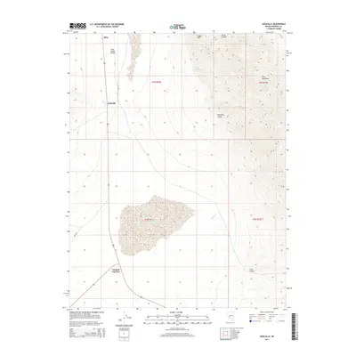
2014 Map of Sodaville
USGS Topo · Published 2014About this map
Soda Spring Valley dominates this Western Nevada landscape, serving as a corridor for the small settlements of Mina and Sodaville. This area is characterized by its arid basins and significant hydrological features, most notably the expansive Rhodes Salt Marsh which occupies the central basin. The map illustrates the convergence of transportation and geography at Tonopah Junction, where road networks like Mono Rd navigate around the high elevations of the Pilot Mountains.
Find a feature on this map
17 named features on this map. Tap any name to fly to it.
Don’t see what you’re looking for? This feature index may not catch every label — zoom into the map to look around manually.
Map Details
Editions of this 2014 Sodaville Map
This is the sole edition of this map. No revisions or reprints were ever made.
Other maps of this area

1907 · Tonopah
USGS Topo · 1:250,000

1908 · Tonopah
USGS Topo · 1:250,000

1909 · Hawthorne
USGS Topo · 1:250,000

1911 · Hawthorne
USGS Topo · 1:250,000

1915 · Hawthorne
USGS Topo · 1:250,000

1948 · Walker Lake
USGS Topo · 1:250,000

1956 · Tonopah
USGS Topo · 1:250,000

1957 · Walker Lake
USGS Topo · 1:250,000

1959 · Tonopah
USGS Topo · 1:250,000

1962 · Walker Lake
USGS Topo · 1:250,000