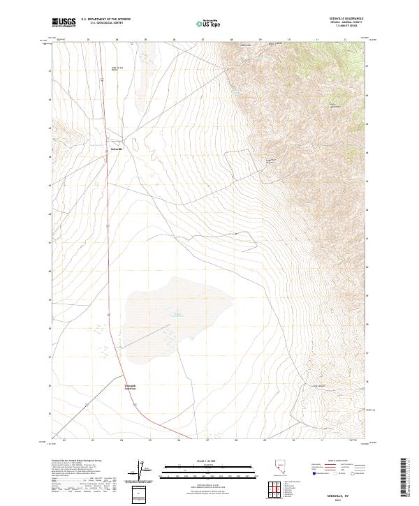
2021 Map of Sodaville
USGS Topo · Published 2021About this map
Sodaville and the nearby Tonopah Junction anchor this high-desert landscape in the Soda Spring Valley. The area is defined by its stark geological and hydrologic features, most notably the expansive Rhodes Salt Marsh which dominates the central basin. This salt flat is a reminder of the region's extractive history and mineral wealth, situated between the steep rises of Llama Mtn to the north and the Pilot Mountains to the east.
Find a feature on this map
16 named features on this map. Tap any name to fly to it.
Don’t see what you’re looking for? This feature index may not catch every label — zoom into the map to look around manually.
Map Details
Editions of this 2021 Sodaville Map
This is the sole edition of this map. No revisions or reprints were ever made.
Other maps of this area

1907 · Tonopah
USGS Topo · 1:250,000

1908 · Tonopah
USGS Topo · 1:250,000

1909 · Hawthorne
USGS Topo · 1:250,000

1911 · Hawthorne
USGS Topo · 1:250,000

1915 · Hawthorne
USGS Topo · 1:250,000

1948 · Walker Lake
USGS Topo · 1:250,000

1956 · Tonopah
USGS Topo · 1:250,000

1957 · Walker Lake
USGS Topo · 1:250,000

1959 · Tonopah
USGS Topo · 1:250,000

1962 · Walker Lake
USGS Topo · 1:250,000