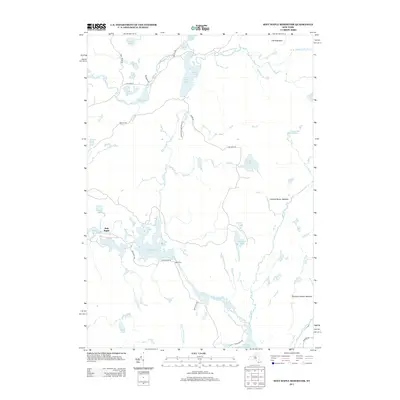
2013 Map of Soft Maple Reservoir
USGS Topo · Published 2013About this map
Adirondack Park Preserve defines the northeastern reaches of this landscape, where the W Br Oswegatchie River and its numerous tributaries cut through a densely forested lake district. This region is characterized by an extensive network of water bodies, ranging from the large Soft Maple Reservoir to smaller secluded basins like Trout Lake and Snider Pond. The hydrology of the area was heavily managed for power and recreation by the early 21st century, as evidenced by the namesake reservoir and the nearby Effley Falls Pond. Settlements are sparse, concentrated around Soft Maple and Eagle Falls, while unique terrain features like The Hogs Back and vast wetlands such as Cowboy Beaver Meadow illustrate the wild character of the Lewis County interior.
Find a feature on this map
44 named features on this map. Tap any name to fly to it.
Don’t see what you’re looking for? This feature index may not catch every label — zoom into the map to look around manually.
Map Details
Editions of this 2013 Soft Maple Reservoir Map
This is the sole edition of this map. No revisions or reprints were ever made.
Other maps of this area

1911 · Lowville
USGS Topo · 1:62,500

1912 · Number Four
USGS Topo · 1:62,500

1913 · Lowville
USGS Topo · 1:62,500

1913 · Lake Bonaparte
USGS Topo · 1:62,500

1915 · Number Four
USGS Topo · 1:62,500

1916 · Lake Bonaparte
USGS Topo · 1:62,500

1916 · Oswegatchie
USGS Topo · 1:62,500

1918 · Oswegatchie
USGS Topo · 1:62,500

1948 · Ogdensburg
USGS Topo · 1:250,000

1950 · Utica
USGS Topo · 1:250,000