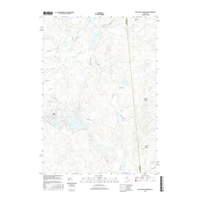
2016 Map of Soft Maple Reservoir
USGS Topo · Published 2016About this map
Beaver River and its associated impoundments dominate this section of the western Adirondacks, where the settlement of Soft Maple serves as a lone residential pocket amidst the protected wilderness. This 2016 survey illustrates the complex hydrology of the Adirondack Park Preserve, featuring the expansive Soft Maple Reservoir and nearby Effley Falls Pond. The landscape is a network of interconnected water bodies and drainages, including the West Branch Oswegatchie River and several distinct beaver meadows such as Cowboy Beaver Meadow and Threemile Beaver Meadow.
Find a feature on this map
47 named features on this map. Tap any name to fly to it.
Don’t see what you’re looking for? This feature index may not catch every label — zoom into the map to look around manually.
Map Details
Editions of this 2016 Soft Maple Reservoir Map
This is the sole edition of this map. No revisions or reprints were ever made.
Other maps of this area

1911 · Lowville
USGS Topo · 1:62,500

1912 · Number Four
USGS Topo · 1:62,500

1913 · Lowville
USGS Topo · 1:62,500

1913 · Lake Bonaparte
USGS Topo · 1:62,500

1915 · Number Four
USGS Topo · 1:62,500

1916 · Lake Bonaparte
USGS Topo · 1:62,500

1916 · Oswegatchie
USGS Topo · 1:62,500

1918 · Oswegatchie
USGS Topo · 1:62,500

1948 · Ogdensburg
USGS Topo · 1:250,000

1950 · Utica
USGS Topo · 1:250,000