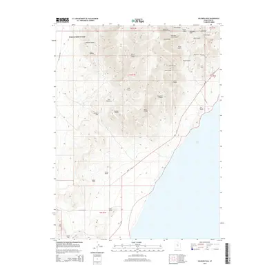
2014 Map of Soldiers Pass
USGS Topo · Published 2014About this map
Utah Lake defines the eastern edge of this western Utah County survey, where the shoreline meets the sharp elevations of the Lake Mountains. The terrain is deeply incised by complex drainage systems including Enoch Canyon, Mercer Canyon, and Pfeiffer Canyon. This 2014 map details the eastern slopes of Eagle Mountain, revealing a landscape marked by distinctive geological formations such as The Knolls, White Knoll, and Black Point. Modern infrastructure is represented by Ut-68, which skirts the lake's western edge, and several secondary routes like Lake Mountain Rd and Coyote Pass Rd. The map also preserves the locations of several ridges and divides, including Enoch Ridge and Dutchman Ridge, along with the eponymous Soldiers Pass, providing a comprehensive view of the area's physical geography before further suburban development expanded through the region.
Find a feature on this map
43 named features on this map. Tap any name to fly to it.
Don’t see what you’re looking for? This feature index may not catch every label — zoom into the map to look around manually.
Map Details
Editions of this 2014 Soldiers Pass Map
This is the sole edition of this map. No revisions or reprints were ever made.
Other maps of this area

1885 · Salt Lake
USGS Topo · 1:250,000

1885 · Tooele Valley
USGS Topo · 1:250,000

1915 · Fairfield
USGS Topo · 1:62,500

1917 · Fairfield
USGS Topo · 1:62,500

1947 · Fivemile Pass
USGS Topo · 1:62,500

1947 · Allens Ranch
USGS Topo · 1:24,000

1947 · Goshen Pass
USGS Topo · 1:24,000

1949 · Allens Ranch
USGS Topo · 1:24,000

1949 · Goshen Pass
USGS Topo · 1:24,000

1950 · West Mountain
USGS Topo · 1:24,000