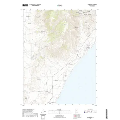
2020 Map of Soldiers Pass
USGS Topo · Published 2020About this map
The Lake Mountains dominate this landscape west of Utah Lake, where complex ridge systems and deep canyons meet the western shoreline. This 2020 survey documents the modern layout of Eagle Mountain and the settlement of Mosida near the water’s edge. The rugged eastern slopes of the range are deeply incised by features like Pfeiffer Canyon, Burnt Canyon, and Chaparral Canyon, while higher elevations are marked by distinctive landmarks such as Miners Ridge and Iron Hill.
Find a feature on this map
44 named features on this map. Tap any name to fly to it.
Don’t see what you’re looking for? This feature index may not catch every label — zoom into the map to look around manually.
Map Details
Editions of this 2020 Soldiers Pass Map
This is the sole edition of this map. No revisions or reprints were ever made.
Other maps of this area

1885 · Salt Lake
USGS Topo · 1:250,000

1885 · Tooele Valley
USGS Topo · 1:250,000

1915 · Fairfield
USGS Topo · 1:62,500

1917 · Fairfield
USGS Topo · 1:62,500

1947 · Fivemile Pass
USGS Topo · 1:62,500

1947 · Allens Ranch
USGS Topo · 1:24,000

1947 · Goshen Pass
USGS Topo · 1:24,000

1949 · Allens Ranch
USGS Topo · 1:24,000

1949 · Goshen Pass
USGS Topo · 1:24,000

1950 · West Mountain
USGS Topo · 1:24,000