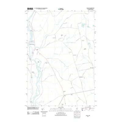
2011 Map of Solon
USGS Topo · Published 2011About this map
The Kennebec River carves through the heart of this Maine landscape, serving as a historic corridor for transportation and industry at Arnolds Landing and the Williams Dam. This 2011 survey documents the dispersed rural settlements of Solon, South Solon, and Embden, where the geography is defined by family-named hills like French Hill and Whipple Hill. Local genealogy is well-preserved through several established burial grounds, including Pierce Cemetery in the north and Jewett Cemetery near the crossroads of Twelve Corners. The network of backroads, such as Meader Farm Rd and Davis Farm Rd, reflects an enduring agricultural tradition. Small water bodies and brooks, including Rowell Pond and Fall Brook, thread through the upland terrain of Rowell Mountain and Parkman Hill, illustrating the complex drainage patterns of the Somerset County highlands.
Find a feature on this map
73 named features on this map. Tap any name to fly to it.
Don’t see what you’re looking for? This feature index may not catch every label — zoom into the map to look around manually.
Map Details
Editions of this 2011 Solon Map
This is the sole edition of this map. No revisions or reprints were ever made.
Other maps of this area

1903 · Bingham
USGS Topo · 1:62,500

1904 · Anson
USGS Topo · 1:62,500

1905 · Bingham
USGS Topo · 1:62,500

1913 · Skowhegan
USGS Topo · 1:62,500

1948 · Bangor
USGS Topo · 1:250,000

1948 · Kingsbury
USGS Topo · 1:62,500

1950 · Kingsbury
USGS Topo · 1:62,500

1954 · Millinocket
USGS Topo · 1:250,000

1955 · Anson
USGS Topo · 1:62,500

1955 · Skowhegan
USGS Topo · 1:62,500