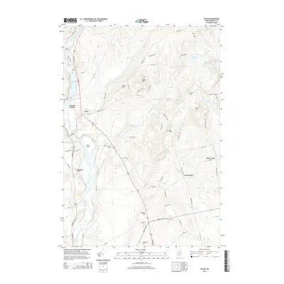
2014 Map of Solon
USGS Topo · Published 2014About this map
The Kennebec River corridor defines the western edge of this Somerset County landscape, where the waters of the Kennebec River Reservoir meet historic riverbank sites like Arnolds Landing. The settlement of Solon serves as a local hub, connected to outlying hamlets such as South Solon and Rice Corner by a network of rural roads that navigate the area's prominent hills. Genealogists and local historians can locate several established burial grounds, including Pierce Cem, Evergreens Cem, and Jewett Cem, scattered among the drainages of Michael Stream and Fall Brook. To the east, the terrain rises significantly toward Rowell Mtn and Eaton Hill, sheltering secluded water bodies like Baker Pond and Chase Pond. The distribution of farm-named routes, such as Meader Farm Rd and Brown Farm Rd, reflects the agricultural foundations of these small Maine townships.
Find a feature on this map
72 named features on this map. Tap any name to fly to it.
Don’t see what you’re looking for? This feature index may not catch every label — zoom into the map to look around manually.
Map Details
Editions of this 2014 Solon Map
This is the sole edition of this map. No revisions or reprints were ever made.
Other maps of this area

1903 · Bingham
USGS Topo · 1:62,500

1904 · Anson
USGS Topo · 1:62,500

1905 · Bingham
USGS Topo · 1:62,500

1913 · Skowhegan
USGS Topo · 1:62,500

1948 · Bangor
USGS Topo · 1:250,000

1948 · Kingsbury
USGS Topo · 1:62,500

1950 · Kingsbury
USGS Topo · 1:62,500

1954 · Millinocket
USGS Topo · 1:250,000

1955 · Anson
USGS Topo · 1:62,500

1955 · Skowhegan
USGS Topo · 1:62,500