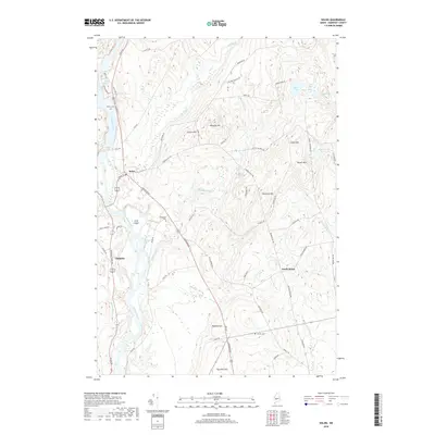
2018 Map of Solon
USGS Topo · Published 2018About this map
The Kennebec River carves a deep valley through this Somerset County landscape, defined by the riverside settlements of Solon and Embden. Near the northern bend of the river, Caratunk Falls marks a significant drop in elevation, while Gray Island sits mid-stream to the south. The topography is dominated by numerous named peaks, including Whipple Hill, Rowell Mtn, and Robbins Hill, which dictate the winding paths of local routes like French Hill Rd and Hole in the Wall Rd.
Find a feature on this map
66 named features on this map. Tap any name to fly to it.
Don’t see what you’re looking for? This feature index may not catch every label — zoom into the map to look around manually.
Map Details
Editions of this 2018 Solon Map
This is the sole edition of this map. No revisions or reprints were ever made.
Other maps of this area

1903 · Bingham
USGS Topo · 1:62,500

1904 · Anson
USGS Topo · 1:62,500

1905 · Bingham
USGS Topo · 1:62,500

1913 · Skowhegan
USGS Topo · 1:62,500

1948 · Bangor
USGS Topo · 1:250,000

1948 · Kingsbury
USGS Topo · 1:62,500

1950 · Kingsbury
USGS Topo · 1:62,500

1954 · Millinocket
USGS Topo · 1:250,000

1955 · Anson
USGS Topo · 1:62,500

1955 · Skowhegan
USGS Topo · 1:62,500