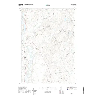
2021 Map of Solon
USGS Topo · Published 2021About this map
The Kennebec River flows southward through this Somerset County landscape, serving as the historical boundary between the towns of Solon and Embden. This modern survey illustrates a region defined by its narrow river valley and the series of prominent heights that flank it, including Rowell Mtn and Robbins Hill. The village of Solon sits at a strategic bend in the river, where Fall Brook enters the main channel. Smaller settlements like South Solon are scattered among the eastern uplands, connected by a network of rural roads such as Brighton Rd and Lakewood Rd. Genealogists will find several documented burial sites throughout the township, including Pierce Cem near the riverbanks and Evergreens Cem further inland. The map also traces the winding courses of Michael Stream and Kincaid Stream as they drain the interior hills into the primary waterway.
Find a feature on this map
65 named features on this map. Tap any name to fly to it.
Don’t see what you’re looking for? This feature index may not catch every label — zoom into the map to look around manually.
Map Details
Editions of this 2021 Solon Map
This is the sole edition of this map. No revisions or reprints were ever made.
Other maps of this area

1903 · Bingham
USGS Topo · 1:62,500

1904 · Anson
USGS Topo · 1:62,500

1905 · Bingham
USGS Topo · 1:62,500

1913 · Skowhegan
USGS Topo · 1:62,500

1948 · Bangor
USGS Topo · 1:250,000

1948 · Kingsbury
USGS Topo · 1:62,500

1950 · Kingsbury
USGS Topo · 1:62,500

1954 · Millinocket
USGS Topo · 1:250,000

1955 · Anson
USGS Topo · 1:62,500

1955 · Skowhegan
USGS Topo · 1:62,500