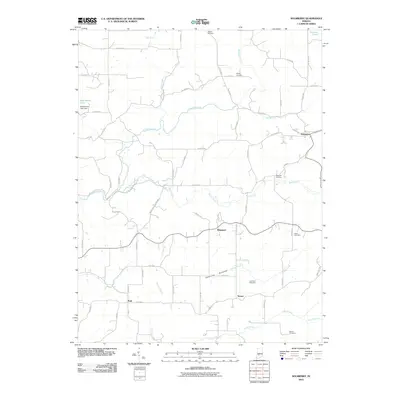
2010 Map of Solsberry
USGS Topo · Published 2010About this map
Richland Creek winds through the northern reaches of this Greene County landscape, defining a network of drainage that includes Beech Creek and Clifty Branch. The small community of Solsberry sits at the eastern edge of the quadrangle, while Ridgeport and Tanner occupy the central and southern corridors. To the west, the American Bottoms area signals a distinct change in the local geography, situated south of Beechwood Lake and its corresponding Beechwood Lake Dam. Family history researchers will find a significant number of burial sites distributed across the township, including Newark Cemetery, Philpot Cemetery, and Bingham Cemetery. The map captures the rural character of the region as it existed in the early 21st century, dominated by a dense grid of county roads such as Co RD 480 N and Co RD 50 S that link these small settlements and family farmsteads.
Find a feature on this map
40 named features on this map. Tap any name to fly to it.
Don’t see what you’re looking for? This feature index may not catch every label — zoom into the map to look around manually.
Map Details
Editions of this 2010 Solsberry Map
This is the sole edition of this map. No revisions or reprints were ever made.
Other maps of this area

1908 · Bloomington
USGS Topo · 1:48,000

1908 · Bloomfield
USGS Topo · 1:62,500

1910 · Bloomington
USGS Topo · 1:62,500

1935 · Oolitic
USGS Topo · 1:48,000

1942 · Oolitic
USGS Topo · 1:62,500

1950 · Arney
USGS Topo · 1:24,000

1951 · Bloomfield
USGS Topo · 1:24,000

1953 · Indianapolis
USGS Topo · 1:250,000

1956 · Indianapolis
USGS Topo · 1:250,000

1956 · Freedom
USGS Topo · 1:24,000