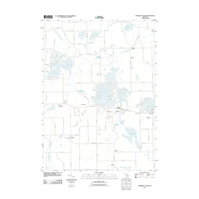
2011 Map of Somerset Center
USGS Topo · Published 2011About this map
Somerset Center and the adjacent town of Somerset anchor the eastern landscape of this early twenty-first-century survey. The region is defined by a complex network of glacial kettle lakes and drainages, including the North Branch Kalamazoo River and the large Lake Somerset. A high density of cemeteries, such as the East Liberty Cemetery, Gambleville Cemetery, and Laurel Hill Cemetery, provides significant documentation for local genealogists. Evidence of small-town infrastructure remains visible through the Somerset Center Post Office, Somerset Post Office, and Jerome Post Office. The central portion of the map showcases more recent residential patterns around water bodies like Lake Le Ann and Crystal Lake, while features like the Putney Millpond hint at the historical water-powered industry that once shaped the surrounding countryside. From the high point at Bunday Hill to the southern reach of Mercer Lakes, the map captures the rural residential and agricultural character of the county.
Find a feature on this map
63 named features on this map. Tap any name to fly to it.
Don’t see what you’re looking for? This feature index may not catch every label — zoom into the map to look around manually.
Map Details
Editions of this 2011 Somerset Center Map
This is the sole edition of this map. No revisions or reprints were ever made.
Other maps of this area

1935 · Jackson
USGS Topo · 1:48,000

1939 · Jackson
USGS Topo · 1:62,500

1948 · Spring Arbor
USGS Topo · 1:62,500

1949 · Spring Arbor
USGS Topo · 1:62,500

1953 · Fort Wayne
USGS Topo · 1:250,000

1956 · Fort Wayne
USGS Topo · 1:250,000

1958 · Grand Rapids
USGS Topo · 1:250,000

1959 · North Adams
USGS Topo · 1:24,000

1961 · Grand Rapids
USGS Topo · 1:250,000

1962 · Grand Rapids
USGS Topo · 1:250,000