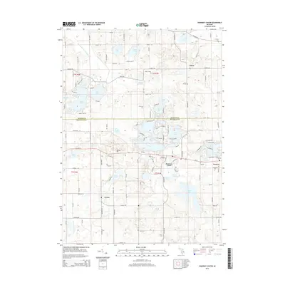
2014 Map of Somerset Center
USGS Topo · Published 2014About this map
Somerset Center and Liberty anchor this rural landscape along the boundary of Jackson and Hillsdale Counties. The area is defined by its glaciated hydrology, featuring numerous kettle lakes such as Crispell Lake, Grand Lake, and the larger Lake Somerset. The headwaters of the North Branch Kalamazoo River and the S Br Kalamazoo River begin their westward courses here, interspersed among family-named landmarks and historic burials. Genealogists will find several notable grounds including Laurel Hill Cem, Gay Cem, and the Somerset Center Cem. High points like Bunday Hill overlook a network of country roads, while the unincorporated community of Jerome sits in the southwest, surrounded by smaller water bodies like Goose Lake and Willet Lake. This modern survey documents the persistent agricultural and residential patterns of southern Michigan.
Find a feature on this map
124 named features on this map. Tap any name to fly to it.
Don’t see what you’re looking for? This feature index may not catch every label — zoom into the map to look around manually.
Map Details
Editions of this 2014 Somerset Center Map
This is the sole edition of this map. No revisions or reprints were ever made.
Other maps of this area

1935 · Jackson
USGS Topo · 1:48,000

1939 · Jackson
USGS Topo · 1:62,500

1948 · Spring Arbor
USGS Topo · 1:62,500

1949 · Spring Arbor
USGS Topo · 1:62,500

1953 · Fort Wayne
USGS Topo · 1:250,000

1956 · Fort Wayne
USGS Topo · 1:250,000

1958 · Grand Rapids
USGS Topo · 1:250,000

1959 · North Adams
USGS Topo · 1:24,000

1961 · Grand Rapids
USGS Topo · 1:250,000

1962 · Grand Rapids
USGS Topo · 1:250,000