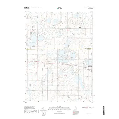
2019 Map of Somerset Center
USGS Topo · Published 2019About this map
Somerset Center and Jerome anchor this part of Hillsdale and Jackson counties, where the landscape is defined by an intricate network of glacial lakes and wetlands. The headwaters of the Br Kalamazoo River emerge near Bunday Hill, winding through a terrain dotted with significant water bodies like Farewell Lake, Crispell Lake, and the expansive Lake Somerset. The map reveals a transition between small-town settlement and rural agriculture, with legacy features such as the Putney Millpond and multiple historical burying grounds including Laurel Hill Cem and East Liberty Cem. The concentration of public access points, such as Crispell Lake Public Acc, highlights the importance of these waterways for local recreation and community life. In the southern half, the proximity of Somerset and Gambleville along the corridor illustrates the persistent settlement patterns in this lake-rich region of Southern Michigan.
Find a feature on this map
132 named features on this map. Tap any name to fly to it.
Don’t see what you’re looking for? This feature index may not catch every label — zoom into the map to look around manually.
Map Details
Editions of this 2019 Somerset Center Map
This is the sole edition of this map. No revisions or reprints were ever made.
Other maps of this area

1935 · Jackson
USGS Topo · 1:48,000

1939 · Jackson
USGS Topo · 1:62,500

1948 · Spring Arbor
USGS Topo · 1:62,500

1949 · Spring Arbor
USGS Topo · 1:62,500

1953 · Fort Wayne
USGS Topo · 1:250,000

1956 · Fort Wayne
USGS Topo · 1:250,000

1958 · Grand Rapids
USGS Topo · 1:250,000

1959 · North Adams
USGS Topo · 1:24,000

1961 · Grand Rapids
USGS Topo · 1:250,000

1962 · Grand Rapids
USGS Topo · 1:250,000