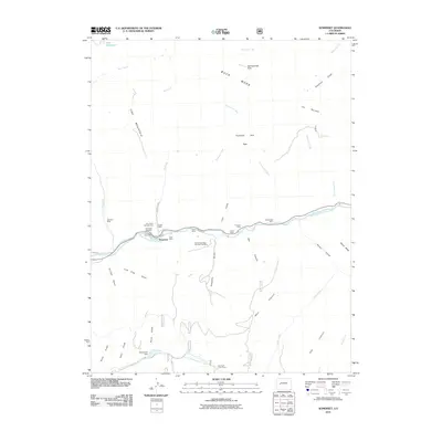
2011 Map of Somerset
USGS Topo · Published 2011About this map
Somerset serves as the focal point of this industrial mountain landscape, where coal extraction and high-altitude ranching intersect along the North Fork Gunnison River. The map documents a dense concentration of mining operations skirting the canyon floor, including the Kaiser Mine, Axelson Mine, and the Mount Gunnison Number One Mine. This industrial corridor contrasts sharply with the expansive terrain above, where Buck Mesa and Thousand Acre Flats dominate the plateau. To the north, the terrain is carved by steep drainages like Thompson Creek and Bear Creek, while the southern reaches show the remote Dry Fork Cow Camp and Monument Dam tucked near the base of the Flatiron. For local historians, the sheet preserves the layout of the town center, featuring the Somerset Post Office and the Somerset Cemetery perched near the river bend.
Find a feature on this map
48 named features on this map. Tap any name to fly to it.
Don’t see what you’re looking for? This feature index may not catch every label — zoom into the map to look around manually.
Map Details
Editions of this 2011 Somerset Map
This is the sole edition of this map. No revisions or reprints were ever made.
Other maps of this area

1938 · Mt. Gunnison
USGS Topo · 1:48,000

1945 · Mount Gunnison
USGS Topo · 1:62,500

1956 · Montrose
USGS Topo · 1:250,000

1957 · Leadville
USGS Topo · 1:250,000

1959 · Leadville
USGS Topo · 1:250,000

1959 · Montrose
USGS Topo · 1:250,000

1960 · Leadville
USGS Topo · 1:250,000

1960 · Montrose
USGS Topo · 1:250,000

1961 · Electric Mountain
USGS Topo · 1:24,000

1962 · Leadville
USGS Topo · 1:250,000