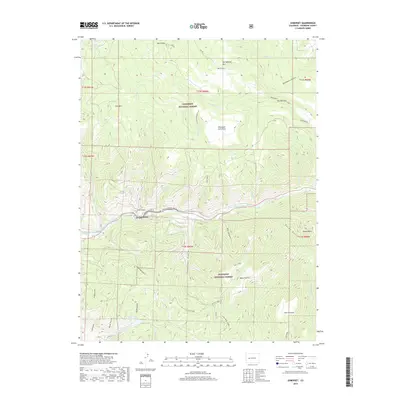
2019 Map of Somerset
USGS Topo · Published 2019About this map
Somerset occupies a narrow shelf along the North Fork Gunnison River in this modern survey of eastern Colorado. The settlement serves as a focal point for the surrounding mountainous terrain, which is dominated by the Gunnison National Forest. Essential water management infrastructure is evident through features like the Fire Mountain Canal and various upland reservoirs, including Hall Reservoir and Minnesota Reservoir.
Find a feature on this map
58 named features on this map. Tap any name to fly to it.
Don’t see what you’re looking for? This feature index may not catch every label — zoom into the map to look around manually.
Map Details
Editions of this 2019 Somerset Map
This is the sole edition of this map. No revisions or reprints were ever made.
Other maps of this area

1938 · Mt. Gunnison
USGS Topo · 1:48,000

1945 · Mount Gunnison
USGS Topo · 1:62,500

1956 · Montrose
USGS Topo · 1:250,000

1957 · Leadville
USGS Topo · 1:250,000

1959 · Leadville
USGS Topo · 1:250,000

1959 · Montrose
USGS Topo · 1:250,000

1960 · Leadville
USGS Topo · 1:250,000

1960 · Montrose
USGS Topo · 1:250,000

1961 · Electric Mountain
USGS Topo · 1:24,000

1962 · Leadville
USGS Topo · 1:250,000