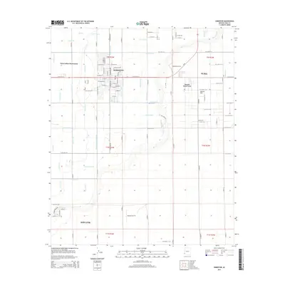
2014 Map of Somerton
USGS Topo · Published 2014About this map
Somerton and the outskirts of San Luis anchor this portion of the Lower Colorado River Valley, a landscape defined by an intricate network of irrigation infrastructure. The agricultural character of the region is evident in the dense grid of water management features, including the Central Canal, Main Drain, and Somerton Canal. This engineered environment supports the area's vital farming industry, which spans from the Yuma Indian Homesteads to the community of Rancho Mesa Verde.
Find a feature on this map
99 named features on this map. Tap any name to fly to it.
Don’t see what you’re looking for? This feature index may not catch every label — zoom into the map to look around manually.
Map Details
Editions of this 2014 Somerton Map
This is the sole edition of this map. No revisions or reprints were ever made.
Other maps of this area

1903 · Yuma
USGS Topo · 1:125,000

1905 · Yuma
USGS Topo · 1:125,000

1940 · Yuma
USGS Topo · 1:62,500

1942 · Yuma
USGS Topo · 1:250,000

1945 · Yuma
USGS Topo · 1:62,500

1952 · Yuma East
USGS Topo · 1:24,000

1952 · Yuma West
USGS Topo · 1:24,000
1953 · Grays Well NE
USGS Topo · 1:24,000

1954 · El Centro
USGS Topo · 1:250,000

1955 · El Centro
USGS Topo · 1:250,000