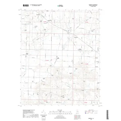
2018 Map of Somerville
USGS Topo · Published 2018About this map
Somerville stands as a focal point in this portion of Morgan County, situated amidst a landscape defined by sharp elevation changes and deep hollows. The town, along with nearby Turney Crossroads and Priceville, reflects the upland settlement patterns of northern Alabama. This survey provides extensive detail for genealogists, documenting numerous family-named burial sites such as Nelson Cem, Houston Cem, and Shiloh Cem. The terrain is characterized by prominent landmarks like Fairview Mtn and Cooper Mtn, which are dissected by complex drainages including Six Mile Cr and Town Cr. Notable natural features like the Natural Bridge in the northwest and Lovers Leap in the southeast suggest a topography of rocky outcroppings and steep bluffs. The distribution of homes and rural structures along routes like Wilson Mountain Rd and Mount Tabor Rd illustrates the community's adaptation to the winding ridges and narrow valleys like Buckeye Hollow and Pannell Hollow.
Find a feature on this map
163 named features on this map. Tap any name to fly to it.
Don’t see what you’re looking for? This feature index may not catch every label — zoom into the map to look around manually.
Map Details
Editions of this 2018 Somerville Map
This is the sole edition of this map. No revisions or reprints were ever made.
Other maps of this area

1888 · Cullman
USGS Topo · 1:125,000

1888 · Huntsville
USGS Topo · 1:125,000

1892 · Cullman
USGS Topo · 1:125,000

1892 · Huntsville
USGS Topo · 1:125,000

1927 · Falkville
USGS Topo · 1:24,000

1936 · Triana
USGS Topo · 1:24,000

1936 · Hartselle
USGS Topo · 1:24,000

1936 · Decatur
USGS Topo · 1:24,000

1936 · Eva
USGS Topo · 1:24,000

1936 · Somerville
USGS Topo · 1:24,000