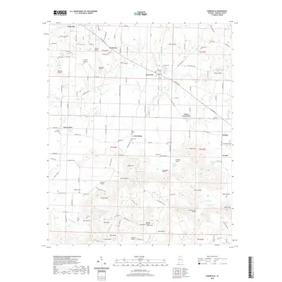
2020 Map of Somerville
USGS Topo · Published 2020About this map
Somerville and Priceville anchor this Morgan County landscape, where the plateau terrain of northern Alabama is marked by deep hollows and prominent ridges. The geography is defined by a series of north-south running valleys and high points such as Fairview Mtn, Cedar Mtn, and Wilson Mtn. This area has long served as an agricultural and residential corridor along AL Highway 67, connecting smaller settlements like Henderson and Gum Spring. Genealogists will find a high density of burial sites documented, including the New Center Baptist Church Cem, Waugh Cem, and Houston Cem. The intricate drainage network of Cedar Creek and Six Mile Creek carves through the limestone, creating features like Devils Cellar Hollow and Lovers Leap, illustrating the complex topography that has shaped local development and road patterns for generations.
Find a feature on this map
166 named features on this map. Tap any name to fly to it.
Don’t see what you’re looking for? This feature index may not catch every label — zoom into the map to look around manually.
Map Details
Editions of this 2020 Somerville Map
This is the sole edition of this map. No revisions or reprints were ever made.
Other maps of this area

1888 · Cullman
USGS Topo · 1:125,000

1888 · Huntsville
USGS Topo · 1:125,000

1892 · Cullman
USGS Topo · 1:125,000

1892 · Huntsville
USGS Topo · 1:125,000

1927 · Falkville
USGS Topo · 1:24,000

1936 · Triana
USGS Topo · 1:24,000

1936 · Hartselle
USGS Topo · 1:24,000

1936 · Decatur
USGS Topo · 1:24,000

1936 · Eva
USGS Topo · 1:24,000

1936 · Somerville
USGS Topo · 1:24,000