
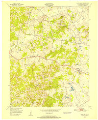
1949 Map of Sonora
USGS Topo · Published 1952About this map
The Nolin River winds through the central Kentucky landscape, carving a path between the established rail communities of Sonora and Glendale. This late 1940s topography captures a transition where the agricultural uplands meet the more complex terrain near Silver Mine Knob. The presence of numerous small springs, such as Boiling Spr and Skees Spring, illustrates the region's underlying karst character, which historically dictated the placement of early homesteads and small mill sites like Star Mills. Cultural life is marked by a network of rural cornerstones, including St. Ignatius Ch and the Glendale Sch, while the Louisville and Nashville railroad corridor and the Dixie Highway serve as the primary conduits for commerce and travel through the Hardin and LaRue County borderlands.
Find a feature on this map
23 named features on this map. Tap any name to fly to it.
Don’t see what you’re looking for? This feature index may not catch every label — zoom into the map to look around manually.
Map Details
Editions of this 1949 Sonora Map
This is the sole edition of this map. No revisions or reprints were ever made.
Other maps of this area

1925 · Cub Run
USGS Topo · 1:62,500

1932 · Big Clifty
USGS Topo · 1:62,500

1934 · Munfordville
USGS Topo · 1:48,000

1935 · Elizabethtown
USGS Topo · 1:48,000

1937 · Munfordville
USGS Topo · 1:62,500

1938 · Elizabethtown
USGS Topo · 1:62,500

1948 · Cecilia
USGS Topo · 1:24,000

1949 · Tonieville
USGS Topo · 1:24,000

1949 · Summit
USGS Topo · 1:24,000
1949 · Howe Valley
USGS Topo · 1:24,000