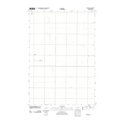
2011 Map of Sonora
USGS Topo · Published 2011About this map
Sonora and its surrounding agricultural reaches in Richland County are defined by a strictly organized grid of section lines and drainage infrastructure. This northern prairie landscape, mapped in 2011, reflects the enduring geometry of American homesteading. While the small settlements of Oswald and De Villo mark specific points of habitation, the map is dominated by the linear path of County Ditch Number 30, a vital waterway for managing the low-relief terrain. To the northwest, Saint Josephs Cemetery stands as a quiet landmark for local genealogical research. The region's transport network is entirely functional, consisting of a precise network of routes like County Rd 81 and County Rd 7 that facilitate the movement of goods across this productive corner of North Dakota.
Find a feature on this map
21 named features on this map. Tap any name to fly to it.
Don’t see what you’re looking for? This feature index may not catch every label — zoom into the map to look around manually.
Map Details
Editions of this 2011 Sonora Map
This is the sole edition of this map. No revisions or reprints were ever made.
Other maps of this area

1904 · Wahpeton
USGS Topo · 1:125,000

1915 · White Rock
USGS Topo · 1:62,500

1917 · New Effington
USGS Topo · 1:62,500

1918 · White Rock
USGS Topo · 1:62,500

1953 · Milbank
USGS Topo · 1:250,000

1953 · Fargo
USGS Topo · 1:250,000

1956 · Fargo
USGS Topo · 1:250,000

1958 · Milbank
USGS Topo · 1:250,000

1964 · Fairmount NW
USGS Topo · 1:24,000

1964 · Hankinson SE
USGS Topo · 1:24,000