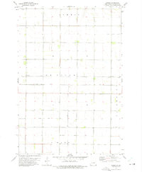
1972 Map of Sonora
USGS Topo · Published 1975About this map
Sonora and the surrounding townships of Summit, Devillo, Fairmount, and Lamars define this portion of Richland County in the early 1970s. The landscape is characterized by a precise grid of sections and an extensive drainage network, including County Ditch No 58, County Ditch No 26, and County Ditch No 30. This infrastructure reflects the intensive agricultural development of the Red River Valley region, where water management was essential for land use.
Find a feature on this map
14 named features on this map. Tap any name to fly to it.
Don’t see what you’re looking for? This feature index may not catch every label — zoom into the map to look around manually.
Map Details
Editions of this 1972 Sonora Map
This is the sole edition of this map. No revisions or reprints were ever made.
Other maps of this area

1904 · Wahpeton
USGS Topo · 1:125,000

1915 · White Rock
USGS Topo · 1:62,500

1917 · New Effington
USGS Topo · 1:62,500

1918 · White Rock
USGS Topo · 1:62,500

1953 · Milbank
USGS Topo · 1:250,000

1953 · Fargo
USGS Topo · 1:250,000

1956 · Fargo
USGS Topo · 1:250,000

1958 · Milbank
USGS Topo · 1:250,000

1964 · Fairmount NW
USGS Topo · 1:24,000

1964 · Hankinson SE
USGS Topo · 1:24,000