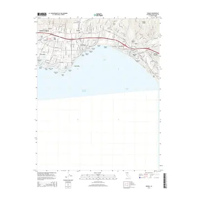
2015 Map of Soquel
USGS Topo · Published 2015About this map
Santa Cruz and its eastern coastal neighbors form a densely developed corridor along the northern edge of Monterey Bay. This survey captures the residential and institutional character of the region, from the campus of Cabrillo College to the numerous lagoons and gulches that break the coastal terrace. The interface between land and sea is marked by prominent features like the Capitola Bluffs and Pleasure Point, which define the local surf and shoreline culture. Inland, the terrain rises into the Santa Cruz Mountains, where Soquel Creek and Bates Creek drain southward toward Capitola. For genealogists and local historians, the presence of Holy Cross Cemetery, Oak Wood Cemetery, and Soquel Cemetery provides essential anchors for family research in this long-settled part of the Central Coast. The transportation network is dominated by the alignment of Soquel Drive and the Highway 1 corridor, linking the communities of Live Oak, Soquel, and Aptos.
Find a feature on this map
61 named features on this map. Tap any name to fly to it.
Don’t see what you’re looking for? This feature index may not catch every label — zoom into the map to look around manually.
Map Details
Editions of this 2015 Soquel Map
This is the sole edition of this map. No revisions or reprints were ever made.
Other maps of this area

1902 · Santa Cruz
USGS Topo · 1:125,000

1912 · Capitola
USGS Topo · 1:62,500

1914 · Capitola
USGS Topo · 1:62,500

1916 · New Almaden
USGS Topo · 1:48,000

1919 · New Almaden
USGS Topo · 1:62,500

1940 · Capitola
USGS Topo · 1:62,500

1940 · Los Gatos
USGS Topo · 1:62,500

1943 · Los Gatos
USGS Topo · 1:62,500

1947 · San Francisco
USGS Topo · 1:250,000

1947 · San Jose
USGS Topo · 1:250,000