2021 Map of Soquel
USGS Topo · Published 2021About this map
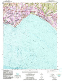
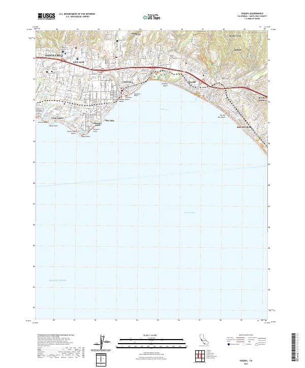
Soquel and Capitola anchor this coastal landscape where the Santa Cruz Mountains meet the Monterey Bay. The terrain is defined by a series of coastal lagoons, including Schwan Lagoon, Corcoran Lagoon, and Bonita Lagoon, which separate the various beach communities. Moving inland, the map shows significant educational and memorial sites like the Cabrillo College Main Campus and several historic burial grounds such as Old Holy Cross Cem and the Soquel Cem. The suburban development patterns of Live Oak and Aptos are clearly visible, bounded by the steep gulches of Arana Gulch and Valencia Cr. The transition from the dense residential areas of Opal Cliffs to the more wooded foothills of Monte Toyon illustrates the region's varied geography. Coastal landmarks like Capitola Bluffs and Pleasure Point mark the interface between the urban grid and the Pacific Ocean.
Find a feature on this map
50 named features on this map. Tap any name to fly to it.
Don’t see what you’re looking for? This feature index may not catch every label — zoom into the map to look around manually.
Map Details
Editions of this 2021 Soquel Map
This is the sole edition of this map. No revisions or reprints were ever made.