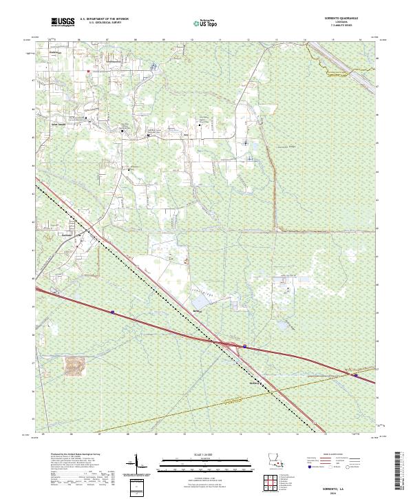
2024 Map of Sorrento
USGS Topo · Published 2024About this map
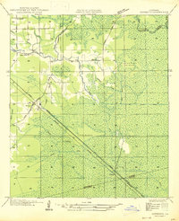
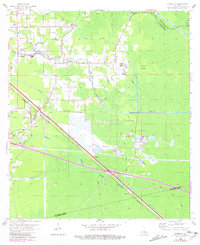
Saint Amant and Sorrento anchor this landscape where the cypress-heavy wetlands of Ascension Parish meet a complex network of man-made and natural waterways. The drainage pattern is a defining characteristic of the region, featuring the historic winding course of the New River alongside major engineering works like the Panama Canal, Anderson Canal, and the Babin Canal. These watercourses dictate the settlement patterns, with roads and homes often following the elevated ground of ridges like Laurel Ridge and Junction Ridge.
Find a feature on this map
76 named features on this map. Tap any name to fly to it.
Don’t see what you’re looking for? This feature index may not catch every label — zoom into the map to look around manually.
Map Details
Editions of this 2024 Sorrento Map
This is the sole edition of this map. No revisions or reprints were ever made.
Historical Maps of Duckroost Through Time
3 maps found