
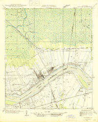
1947 Map of Sorrento
USGS Topo · Published 1947About this map
Sorrento sits at the intersection of critical 1930s transport arteries, where the Louisiana and Arkansas Railway and the Airline Highway cut a sharp diagonal through the low-lying wetlands of Ascension Parish. The landscape is defined by an intricate network of waterways and early 20th-century drainage engineering, including the Panama Canal, New River Canal, and Saveiro Canal. These man-made channels intermingle with natural features like Bayou Pierre and Black Bayou, illustrating the era's intensive efforts to manage the water-heavy terrain for settlement and transit.
Find a feature on this map
27 named features on this map. Tap any name to fly to it.
Don’t see what you’re looking for? This feature index may not catch every label — zoom into the map to look around manually.
Map Details
Editions of this 1947 Sorrento Map
This is the sole edition of this map. No revisions or reprints were ever made.
Other maps of this area

1892 · Mount Airy
USGS Topo · 1:62,500

1892 · Donaldsonville
USGS Topo · 1:62,500

1934 · Denham Springs
USGS Topo · 1:62,500

1934 · Springfield
USGS Topo · 1:62,500

1935 · Gonzales
USGS Topo · 1:31,680

1939 · Springfield
USGS Topo · 1:62,500

1939 · Denham Springs
USGS Topo · 1:62,500

1939 · Donaldsonville
USGS Topo · 1:62,500

1946 · Convent
USGS Topo · 1:31,680
1946 · Lutcher
USGS Topo · 1:31,680