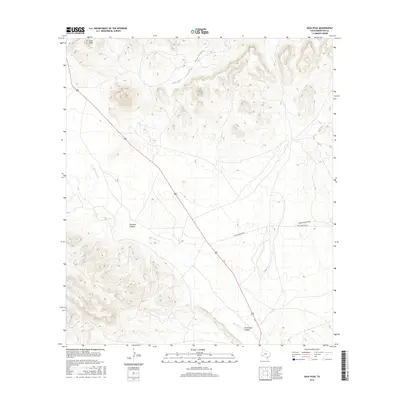
2016 Map of Sosa Peak
USGS Topo · Published 2016About this map
Sosa Peak dominates this high-altitude landscape of Brewster County, where dramatic elevation changes define the local geography. The map reveals a complex system of drainage and erosion, most notably through the deep incisions of Big Dark Canyon and Little Dark Canyon. Water management and natural flow are traced through the path of Maravillas Cr, which winds through the southern portion of the quadrangle. Transportation through this isolated terrain is limited to a few primary arteries, including Dove Mountain Rd and Desert Mountain Rd, which provide access across the arid flats and toward the surrounding peaks. This 2016 survey captures the area's geological character, emphasizing the interplay between the desert floor and the steep escarpments that characterize this section of the Trans-Pecos region.
Find a feature on this map
6 named features on this map. Tap any name to fly to it.
Don’t see what you’re looking for? This feature index may not catch every label — zoom into the map to look around manually.
Map Details
Editions of this 2016 Sosa Peak Map
This is the sole edition of this map. No revisions or reprints were ever made.
Other maps of this area

1917 · Santiago Peak
USGS Topo · 1:62,500

1917 · Bone Spring
USGS Topo · 1:62,500

1917 · Hood Spring
USGS Topo · 1:62,500

1918 · Bone Spring
USGS Topo · 1:125,000

1918 · Hood Spring
USGS Topo · 1:62,500

1918 · Santiago Peak
USGS Topo · 1:62,500

1918 · Bone Spring
USGS Topo · 1:62,500

1918 · Nine Point Mesa
USGS Topo · 1:62,500

1920 · Bone Spring
USGS Topo · 1:62,500

1931 · Hood Spring
USGS Topo · 1:62,500