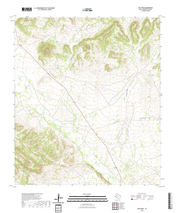
2022 Map of Sosa Peak
USGS Topo · Published 2022About this map
Sosa Peak stands as a prominent high point in this corner of Brewster County, marking a landscape defined by sharp elevation shifts and deep drainage systems. The northern reaches are carved by the dramatic incisions of Big Dark Canyon and Little Dark Canyon, which channel toward the south. This terrain transitions into the high ridges of the Santiago Mountains in the southwest, where steep contours reflect the complex geology of the Trans-Pecos region. The ephemeral path of Maravillas Cr snakes across the central flats, a vital hydrologic feature in an otherwise arid environment. Human presence is sparse, limited primarily to unpaved access routes like Dove Mountain Rd and Desert Mountain Rd, which navigate the wide basins between the mountain ranges.
Find a feature on this map
7 named features on this map. Tap any name to fly to it.
Don’t see what you’re looking for? This feature index may not catch every label — zoom into the map to look around manually.
Map Details
Editions of this 2022 Sosa Peak Map
This is the sole edition of this map. No revisions or reprints were ever made.
Other maps of this area

1917 · Santiago Peak
USGS Topo · 1:62,500

1917 · Bone Spring
USGS Topo · 1:62,500

1917 · Hood Spring
USGS Topo · 1:62,500

1918 · Bone Spring
USGS Topo · 1:125,000

1918 · Hood Spring
USGS Topo · 1:62,500

1918 · Santiago Peak
USGS Topo · 1:62,500

1918 · Bone Spring
USGS Topo · 1:62,500

1918 · Nine Point Mesa
USGS Topo · 1:62,500

1920 · Bone Spring
USGS Topo · 1:62,500

1931 · Hood Spring
USGS Topo · 1:62,500