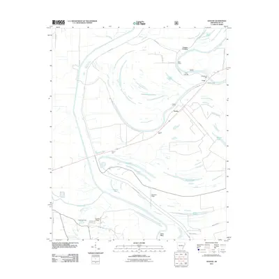
2011 Map of Soudan
USGS Topo · Published 2011About this map
The St Francis Floodway and Saint Francis River dominate this 2011 landscape of Lee County, Arkansas, where water engineering and historical river commerce define the terrain. The central settlement of Soudan sits along the rail line, flanked by markers of the area's river-dependent past such as Soudan Landing and Vanness Crossing. Sandbars and river features like True Love Bar and Cow Bayou Bar reflect the shifting nature of these waterways, while a massive levee system protect the agricultural flats from the floodwaters of the L'Anguille River. To the south, Crowley Ridge and Skidmore Ridge provide subtle elevation above the delta floor. Local history is anchored by the Soudan Cemetery and the site of the Crystal Lake Dam near Patterson Creek.
Find a feature on this map
46 named features on this map. Tap any name to fly to it.
Don’t see what you’re looking for? This feature index may not catch every label — zoom into the map to look around manually.
Map Details
Editions of this 2011 Soudan Map
This is the sole edition of this map. No revisions or reprints were ever made.
Other maps of this area

1939 · Park Place
USGS Topo · 1:62,500

1939 · Latour
USGS Topo · 1:62,500

1940 · Marvell
USGS Topo · 1:62,500

1940 · Marianna
USGS Topo · 1:62,500

1948 · Helena
USGS Topo · 1:250,000

1950 · Helena
USGS Topo · 1:250,000

1955 · Park Place
USGS Topo · 1:62,500

1955 · Latour
USGS Topo · 1:62,500

1955 · Helena
USGS Topo · 1:250,000

1956 · Marvell
USGS Topo · 1:62,500