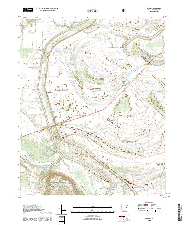
2024 Map of Soudan
USGS Topo · Published 2024About this map
The confluence of the Saint Francis River and the L'Anguille River dominates this landscape in Lee County, Arkansas. The terrain is defined by the elevation of Crowleys Ridge and Skidmore Ridge, which rise above the surrounding wetlands and bayous. The Madison-Marianna Diversion reflects a century of sophisticated water management and drainage efforts required to sustain agriculture in this alluvial plain. Small settlements such as Soudan and Cody are connected by a network of rural routes, including State Hwy 121 and Lee Road 717. For genealogists and local historians, the map preserves the location of the Soudan Cem and the John Patterson Grave, providing essential coordinates for tracing early residents. The southern portion of the map transitions into the protected woodlands of the St Francis National Forest, where the topography shifts from flat drainage basins into more varied ridges and hollows.
Find a feature on this map
47 named features on this map. Tap any name to fly to it.
Don’t see what you’re looking for? This feature index may not catch every label — zoom into the map to look around manually.
Map Details
Editions of this 2024 Soudan Map
This is the sole edition of this map. No revisions or reprints were ever made.
Other maps of this area

1939 · Park Place
USGS Topo · 1:62,500

1939 · Latour
USGS Topo · 1:62,500

1940 · Marvell
USGS Topo · 1:62,500

1940 · Marianna
USGS Topo · 1:62,500

1948 · Helena
USGS Topo · 1:250,000

1950 · Helena
USGS Topo · 1:250,000

1955 · Park Place
USGS Topo · 1:62,500

1955 · Latour
USGS Topo · 1:62,500

1955 · Helena
USGS Topo · 1:250,000

1956 · Marvell
USGS Topo · 1:62,500