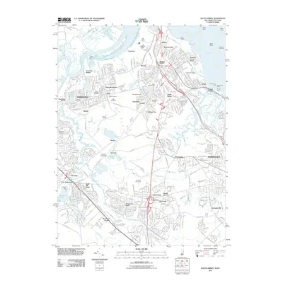
2011 Map of South Amboy
USGS Topo · Published 2011About this map
South Amboy and Sayreville anchor this coastal landscape where the Raritan River meets Raritan Bay. The 2011 survey reveals an area defined by dense residential growth and a deep history of transport and industry, evidenced by the Raritan River RR and the Perth Amboy Water Works. A significant concentration of ecclesiastical sites, including Saint Marys Cemetery, Sacred Heart Cemetery, and Beth Israel Cemetery, suggests the long-standing community roots of several generations. Along the shoreline, the Great Beds Lighthouse and Cheesequake Light serve as navigational markers near Morgan Beach. Further inland, the map captures the suburban character of Madison Park and Old Bridge, while the Duhernal Dam on Duhernal Lake indicates the managed water resources essential to the region's development.
Find a feature on this map
95 named features on this map. Tap any name to fly to it.
Don’t see what you’re looking for? This feature index may not catch every label — zoom into the map to look around manually.
Map Details
Editions of this 2011 South Amboy Map
This is the sole edition of this map. No revisions or reprints were ever made.
Other maps of this area

1888 · Plainfield
USGS Topo · 1:62,500

1888 · New Brunswick
USGS Topo · 1:62,500

1888 · Sandy Hook
USGS Topo · 1:62,500

1893 · New Brunswick
USGS Topo · 1:62,500

1893 · Plainfield
USGS Topo · 1:62,500

1893 · Sandy Hook
USGS Topo · 1:62,500

1898 · Plainfield
USGS Topo · 1:62,500

1898 · Staten Island
USGS Topo · 1:62,500

1900 · Passaic
USGS Topo · 1:125,000

1900 · Staten Island
USGS Topo · 1:62,500