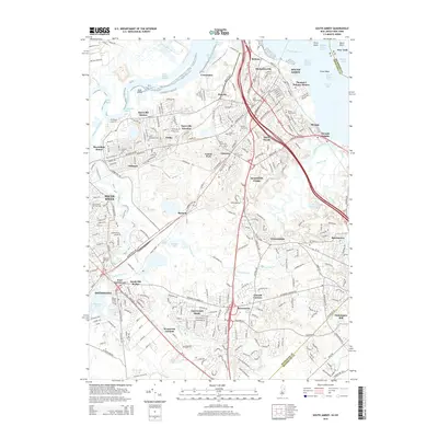
2014 Map of South Amboy
USGS Topo · Published 2014About this map
The Raritan River and Raritan Bay dominate this coastal New Jersey landscape, defining a complex network of industrial reaches and tidal channels. Along the northern shoreline, South Amboy and Sayreville Station sit at the nexus of major transport corridors, where the Raritan River Cutoff and Washington Canal carve into the terrain. The map documents an area deeply layered with residential and industrial history, from the Thomas J Dohany Homes in the north to the southern reaches of Sayerwood South and Henningers Mill.
Find a feature on this map
87 named features on this map. Tap any name to fly to it.
Don’t see what you’re looking for? This feature index may not catch every label — zoom into the map to look around manually.
Map Details
Editions of this 2014 South Amboy Map
This is the sole edition of this map. No revisions or reprints were ever made.
Other maps of this area

1888 · Plainfield
USGS Topo · 1:62,500

1888 · New Brunswick
USGS Topo · 1:62,500

1888 · Sandy Hook
USGS Topo · 1:62,500

1893 · New Brunswick
USGS Topo · 1:62,500

1893 · Plainfield
USGS Topo · 1:62,500

1893 · Sandy Hook
USGS Topo · 1:62,500

1898 · Plainfield
USGS Topo · 1:62,500

1898 · Staten Island
USGS Topo · 1:62,500

1900 · Passaic
USGS Topo · 1:125,000

1900 · Staten Island
USGS Topo · 1:62,500