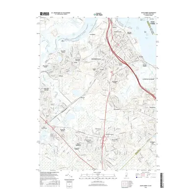
2016 Map of South Amboy
USGS Topo · Published 2016About this map
The Raritan River dominates this coastal landscape, serving as a critical artery for industrial and residential growth in northern New Jersey. On its southern banks, the city of South Amboy and the borough of Sayreville exhibit dense development patterns, linked by the New York & Long Branch RR and major thoroughfares like the Garden State Pkwy. The map documents a complex network of neighborhoods including Parlin, Morgan, and Mechanicsville, alongside extensive marshlands such as the Burnt Fly Bog and Crab Island. Further inland, the settlements of Old Bridge and South River appear alongside local landmarks like Henningers Mill and several historic burial grounds, including Saint Marys Cem and Beth Israel Cem, which offer significant value for genealogical research.
Find a feature on this map
81 named features on this map. Tap any name to fly to it.
Don’t see what you’re looking for? This feature index may not catch every label — zoom into the map to look around manually.
Map Details
Editions of this 2016 South Amboy Map
This is the sole edition of this map. No revisions or reprints were ever made.
Other maps of this area

1888 · Plainfield
USGS Topo · 1:62,500

1888 · New Brunswick
USGS Topo · 1:62,500

1888 · Sandy Hook
USGS Topo · 1:62,500

1893 · New Brunswick
USGS Topo · 1:62,500

1893 · Plainfield
USGS Topo · 1:62,500

1893 · Sandy Hook
USGS Topo · 1:62,500

1898 · Plainfield
USGS Topo · 1:62,500

1898 · Staten Island
USGS Topo · 1:62,500

1900 · Passaic
USGS Topo · 1:125,000

1900 · Staten Island
USGS Topo · 1:62,500