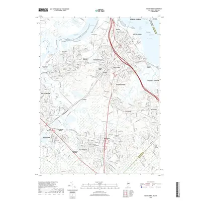
2019 Map of South Amboy
USGS Topo · Published 2019About this map
South Amboy and Perth Amboy dominate the northern industrial shoreline where the Raritan River meets Raritan Bay. The landscape is a complex intersection of historic maritime industry and dense residential development, characterized by numerous neighborhoods like Mechanicsville, Melrose, and MacArthur Manor. Extensive infrastructure supports this corridor, including the Edison Brg and the Garden State Pkwy, which cut through a terrain marked by tidal reaches such as Titanium Reach and Crab Island Reach.
Find a feature on this map
80 named features on this map. Tap any name to fly to it.
Don’t see what you’re looking for? This feature index may not catch every label — zoom into the map to look around manually.
Map Details
Editions of this 2019 South Amboy Map
This is the sole edition of this map. No revisions or reprints were ever made.
Other maps of this area

1888 · Plainfield
USGS Topo · 1:62,500

1888 · New Brunswick
USGS Topo · 1:62,500

1888 · Sandy Hook
USGS Topo · 1:62,500

1893 · New Brunswick
USGS Topo · 1:62,500

1893 · Plainfield
USGS Topo · 1:62,500

1893 · Sandy Hook
USGS Topo · 1:62,500

1898 · Plainfield
USGS Topo · 1:62,500

1898 · Staten Island
USGS Topo · 1:62,500

1900 · Passaic
USGS Topo · 1:125,000

1900 · Staten Island
USGS Topo · 1:62,500