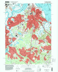
1995 Map of South Amboy
USGS Topo · Published 2000About this map
The Raritan Bay waterfront and the industrial corridors of the Raritan River define this mid-1990s landscape at the junction of Middlesex and Monmouth counties. Dense residential development in South Amboy and Sayreville is intersected by major transit arteries including the New Jersey Turnpike and the Garden State Parkway. The map reveals a complex history of infrastructure, from the rail hubs at Sayreville Junction and South Amboy Junction to the extensive Sand and Gravel Pits that shaped the local topography.
Find a feature on this map
81 named features on this map. Tap any name to fly to it.
Don’t see what you’re looking for? This feature index may not catch every label — zoom into the map to look around manually.
Map Details
Editions of this 1995 South Amboy Map
This is the sole edition of this map. No revisions or reprints were ever made.
Other maps of this area

1888 · Plainfield
USGS Topo · 1:62,500

1888 · New Brunswick
USGS Topo · 1:62,500

1888 · Sandy Hook
USGS Topo · 1:62,500

1893 · New Brunswick
USGS Topo · 1:62,500

1893 · Plainfield
USGS Topo · 1:62,500

1893 · Sandy Hook
USGS Topo · 1:62,500

1898 · Plainfield
USGS Topo · 1:62,500

1898 · Staten Island
USGS Topo · 1:62,500

1900 · Passaic
USGS Topo · 1:125,000

1900 · Staten Island
USGS Topo · 1:62,500