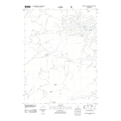
2011 Map of South Bald Mountain
USGS Topo · Published 2011About this map
Black Mountain Ranch and its neighboring Black Mountain Ranch Cemetery serve as the primary human touchstones in this high-elevation Larimer County landscape. The area is defined by the complex hydrography of the North Fork Cache la Poudre River, which gathers waters from several high-country drainages including Killpecker Creek and Beartrap Creek. Infrastructure is concentrated in the northeast near Panhandle Reservoir, where a network of residential roads like Arapahoe Way and Osage Trl suggest modern recreational or seasonal settlement patterns. The southern reaches are dominated by the significant massifs of North Bald Mountain, Middle Bald Mountain, and South Bald Mountain. Historical resource extraction is noted at Hill Mine and Redfeather Pit, while public access is facilitated by the North Fork Poudre Campground and the North Lone Pine Trailhead.
Find a feature on this map
59 named features on this map. Tap any name to fly to it.
Don’t see what you’re looking for? This feature index may not catch every label — zoom into the map to look around manually.
Map Details
Editions of this 2011 South Bald Mountain Map
This is the sole edition of this map. No revisions or reprints were ever made.
Other maps of this area

1916 · Home
USGS Topo · 1:125,000

1920 · Home
USGS Topo · 1:125,000

1954 · Greeley
USGS Topo · 1:250,000

1957 · Greeley
USGS Topo · 1:250,000

1958 · Greeley
USGS Topo · 1:250,000

1961 · Greeley
USGS Topo · 1:250,000

1962 · Boston Peak
USGS Topo · 1:24,000

1962 · Kinikinik
USGS Topo · 1:24,000
1962 · Rustic
USGS Topo · 1:24,000

1964 · Greeley
USGS Topo · 1:250,000