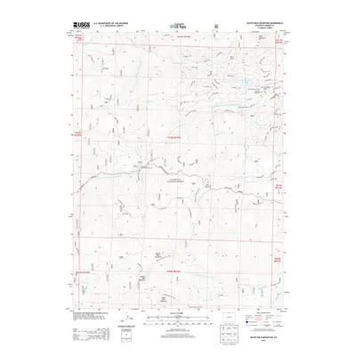
2013 Map of South Bald Mountain
USGS Topo · Published 2013About this map
Roosevelt National Forest dominates this high-altitude landscape, centered on the prominent trio of North Bald Mountain, Middle Bald Mountain, and South Bald Mountain. The area is defined by a network of ranching and recreational sites, including the Black Mountain Ranch and its associated Black Mtn Ranch Cem. Water management is evident through the presence of the Mitchell Ditch and Bellaire Ditch, which redirect the flow of the North Fork Cache La Poudre River and other drainage systems like Elkhorn Creek and Killpecker Creek. A significant network of unpaved forest roads and trails, such as Deadman Rd and the Pearl Creek Trail 950, provides access to the North Fork Poudre Campground and the Lone Tree Ranch Airport. The residential pockets of Painted Post Ranch and various named drives suggest a blend of working ranch lands and more recent high-country settlement during the early 21st century.
Find a feature on this map
73 named features on this map. Tap any name to fly to it.
Don’t see what you’re looking for? This feature index may not catch every label — zoom into the map to look around manually.
Map Details
Editions of this 2013 South Bald Mountain Map
This is the sole edition of this map. No revisions or reprints were ever made.
Other maps of this area

1916 · Home
USGS Topo · 1:125,000

1920 · Home
USGS Topo · 1:125,000

1954 · Greeley
USGS Topo · 1:250,000

1957 · Greeley
USGS Topo · 1:250,000

1958 · Greeley
USGS Topo · 1:250,000

1961 · Greeley
USGS Topo · 1:250,000

1962 · Boston Peak
USGS Topo · 1:24,000

1962 · Kinikinik
USGS Topo · 1:24,000
1962 · Rustic
USGS Topo · 1:24,000

1964 · Greeley
USGS Topo · 1:250,000