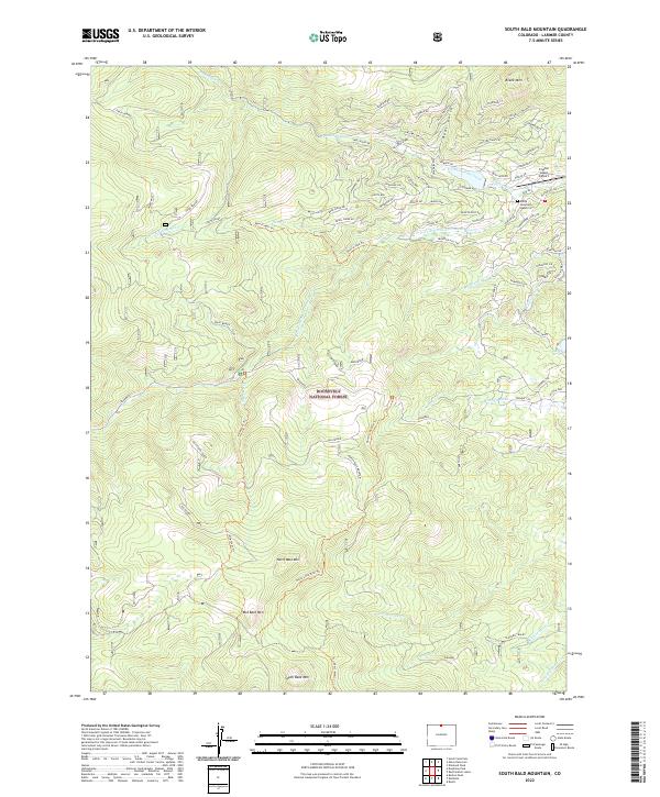
2022 Map of South Bald Mountain
USGS Topo · Published 2022About this map
North Bald Mountain and its sibling peaks, Mid Bald Mtn and South Bald Mtn, dominate the high-elevation landscape within the Roosevelt National Forest. This 2022 survey documents a rugged transition where the peaks of the Front Range descend into a complex network of forest roads and modern developments. In the northeastern corner, the Crystal Lakes area shows a dense grid of residential streets with tribal and local names like Chickasaw Ct, Navajo Rd, and Comanche Cir. This neighborhood is served by the Crystal Lakes Airport and contains the Black Mountain Ranch Cemetery. Water management is evident through the presence of the Mitchell Ditch and Bellaire Ditch, which divert flows near the headwaters of the N Fork Cache La Poudre River and S Lone Pine Cr.
Find a feature on this map
89 named features on this map. Tap any name to fly to it.
Don’t see what you’re looking for? This feature index may not catch every label — zoom into the map to look around manually.
Map Details
Editions of this 2022 South Bald Mountain Map
This is the sole edition of this map. No revisions or reprints were ever made.
Other maps of this area

1916 · Home
USGS Topo · 1:125,000

1920 · Home
USGS Topo · 1:125,000

1954 · Greeley
USGS Topo · 1:250,000

1957 · Greeley
USGS Topo · 1:250,000

1958 · Greeley
USGS Topo · 1:250,000

1961 · Greeley
USGS Topo · 1:250,000

1962 · Boston Peak
USGS Topo · 1:24,000

1962 · Kinikinik
USGS Topo · 1:24,000
1962 · Rustic
USGS Topo · 1:24,000

1964 · Greeley
USGS Topo · 1:250,000