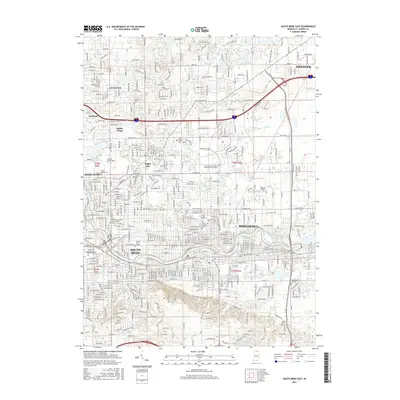
2016 Map of South Bend East
USGS Topo · Published 2016About this map
The St Joseph River defines the urban corridor of North Central Indiana, anchoring the sprawling growth of South Bend and Mishawaka. This modern-era survey highlights the dense concentration of educational and religious institutions, most notably the extensive grounds of Notre Dame and the Univ of Notre Dame. The landscape is a mix of collegiate campuses, residential neighborhoods like Indian Village and Maple Lane, and industrial history reflected by the Grand Trunk Western RR. Genealogists will find a wealth of data points across the quadrangle, from the Cedar Grove Cem near the university to the Saint Josephs Cem and Fairview Cem further south. The map also captures the suburban reach extending toward Granger and Georgetown in the north, showing how the mid-century street grid has filled the spaces between historic family burial sites like Stuckey Cem and Eutzler Cem.
Find a feature on this map
61 named features on this map. Tap any name to fly to it.
Don’t see what you’re looking for? This feature index may not catch every label — zoom into the map to look around manually.
Map Details
Editions of this 2016 South Bend East Map
This is the sole edition of this map. No revisions or reprints were ever made.
Other maps of this area

1927 · Niles
USGS Topo · 1:62,500

1930 · Niles
USGS Topo · 1:62,500

1943 · Niles
USGS Topo · 1:62,500

1945 · Cassopolis
USGS Topo · 1:62,500

1947 · Cassopolis
USGS Topo · 1:62,500

1953 · Chicago
USGS Topo · 1:250,000

1957 · Chicago
USGS Topo · 1:250,000

1958 · South Bend East
USGS Topo · 1:24,000

1958 · South Bend West
USGS Topo · 1:24,000

1958 · Osceola
USGS Topo · 1:24,000