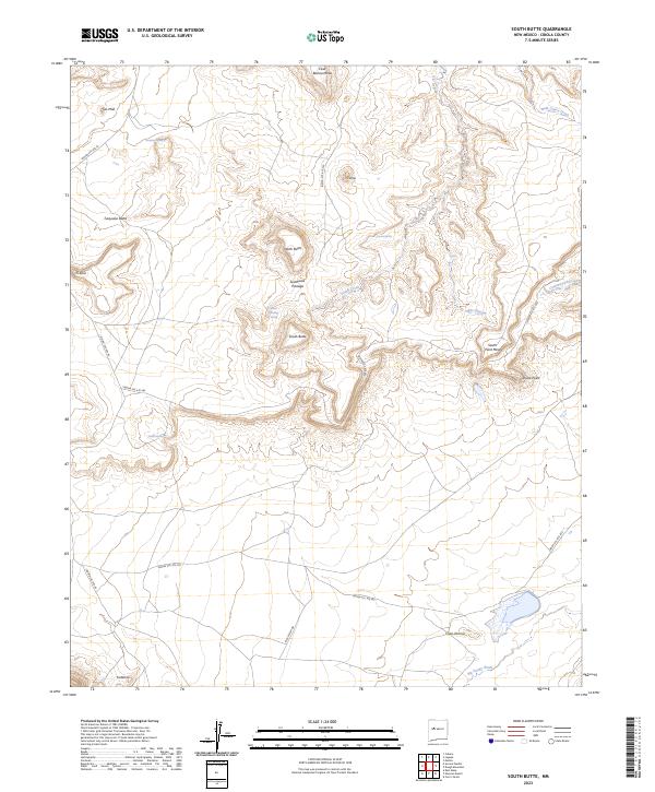
2023 Map of South Butte
USGS Topo · Published 2023About this map
South Butte and its surrounding high-desert mesas define the geography of this central New Mexico landscape in Cibola County. The map details a network of water sources essential to this arid environment, including Kemp Santiago Spring, Alamo Spring, and Turquois Spring. These points of life contrast with the dry drainages of Rio Gypsum and Big Sandy Wash.
Find a feature on this map
31 named features on this map. Tap any name to fly to it.
Don’t see what you’re looking for? This feature index may not catch every label — zoom into the map to look around manually.
Map Details
Editions of this 2023 South Butte Map
This is the sole edition of this map. No revisions or reprints were ever made.
Other maps of this area

1883 · Mt. Taylor
USGS Topo · 1:250,000

1886 · Mt. Taylor
USGS Topo · 1:250,000

1892 · Mt. Taylor
USGS Topo · 1:250,000

1899 · Mt. Taylor
USGS Topo · 1:250,000

1917 · Cerro Verde
USGS Topo · 1:125,000

1917 · Broom Mountain
USGS Topo · 1:125,000

1954 · Socorro
USGS Topo · 1:250,000

1957 · Laguna
USGS Topo · 1:24,000

1957 · Cubero
USGS Topo · 1:24,000

1957 · Mesita
USGS Topo · 1:24,000