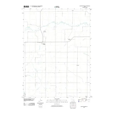
2010 Map of South English
USGS Topo · Published 2010About this map
South English sits at the heart of this agricultural landscape in Keokuk County, serving as a primary point of settlement along the state highway corridor. The town is anchored by the South English Post Office and surrounded by a network of rural burial grounds that speak to the long-standing community roots in the area, including the South English Cemetery and the Church of the Brethren Cemetery. The terrain is defined by the meandering course of the South English River, which is joined by several tributaries such as Troublesome Creek and Smith Creek. Further south, the map identifies the small community of Creswell, located amidst a grid of section roads that provide access to the outlying Lafayette Cemetery and Pleasant Hill Cemetery. The interplay between the river's winding path and the rigid rectangular survey grid illustrates the classic midwestern pattern of settlement adapted to riparian geography.
Find a feature on this map
41 named features on this map. Tap any name to fly to it.
Don’t see what you’re looking for? This feature index may not catch every label — zoom into the map to look around manually.
Map Details
Editions of this 2010 South English Map
This is the sole edition of this map. No revisions or reprints were ever made.
Other maps of this area

1891 · Oxford
USGS Topo · 1:62,500

1894 · Oxford
USGS Topo · 1:62,500

1903 · Fairfax
USGS Topo · 1:125,000

1954 · Des Moines
USGS Topo · 1:250,000

1956 · Des Moines
USGS Topo · 1:250,000

1957 · Des Moines
USGS Topo · 1:250,000

1958 · Davenport
USGS Topo · 1:250,000

1961 · Davenport
USGS Topo · 1:250,000

1962 · Davenport
USGS Topo · 1:250,000

1965 · Keswick
USGS Topo · 1:24,000