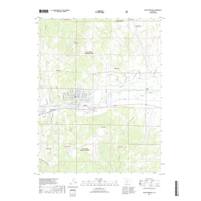
2019 Map of South Fork East
USGS Topo · Published 2019About this map
The Rio Grande flows prominently across this high-altitude landscape, where the settlements of Alpine and Gerrard mark the intersection of valley life and mountain wilderness. This 2019 survey by the U.S. Geological Survey illustrates a complex network of water management, with the Anaconda Ditch, Minor Ditch, and Santa Maria Highline Ditch diverting water through the valley floor. To the north, the terrain rises toward Agua Ramon Mtn, while the southern reaches are dominated by the elevations of Shaw Mesa and Beaver Mountain.
Find a feature on this map
90 named features on this map. Tap any name to fly to it.
Don’t see what you’re looking for? This feature index may not catch every label — zoom into the map to look around manually.
Map Details
Editions of this 2019 South Fork East Map
This is the sole edition of this map. No revisions or reprints were ever made.
Other maps of this area

1914 · Creede
USGS Topo · 1:125,000

1915 · Del Norte
USGS Topo · 1:125,000

1916 · Creede
USGS Topo · 1:125,000

1917 · Del Norte
USGS Topo · 1:125,000

1945 · Durango
USGS Topo · 1:250,000

1953 · Durango
USGS Topo · 1:250,000

1954 · Durango
USGS Topo · 1:250,000

1961 · Durango
USGS Topo · 1:250,000

1963 · Durango
USGS Topo · 1:250,000

1966 · Durango
USGS Topo · 1:250,000