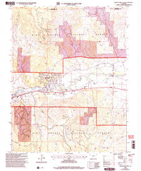
2001 Map of South Fork East
USGS Topo · Published 2005About this map
Agua Ramon and the riverside development of Alpine Village center this study of the Rio Grande valley at the turn of the 21st century. The landscape is defined by the transition from the high, flat expanse of Shaw Mesa and Wolf Mountain down to the fertile corridor of the Rio Grande River. A sophisticated network of irrigation, including the Anaconda Ditch and Meadow Ditch, underscores the area's agricultural reliance on the river's flow.
Find a feature on this map
36 named features on this map. Tap any name to fly to it.
Don’t see what you’re looking for? This feature index may not catch every label — zoom into the map to look around manually.
Map Details
Editions of this 2001 South Fork East Map
This is the sole edition of this map. No revisions or reprints were ever made.
Other maps of this area

1914 · Creede
USGS Topo · 1:125,000

1915 · Del Norte
USGS Topo · 1:125,000

1916 · Creede
USGS Topo · 1:125,000

1917 · Del Norte
USGS Topo · 1:125,000

1945 · Durango
USGS Topo · 1:250,000

1953 · Durango
USGS Topo · 1:250,000

1954 · Durango
USGS Topo · 1:250,000

1961 · Durango
USGS Topo · 1:250,000

1963 · Durango
USGS Topo · 1:250,000

1966 · Durango
USGS Topo · 1:250,000