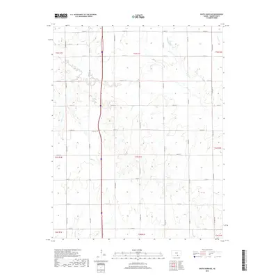
2018 Map of South Haven NE
USGS Topo · Published 2018About this map
Jordan Cem stands as a quiet landmark within the rural landscape of southern Sumner County, situated among the sections of T33S R1E. The terrain is defined by a dense network of watercourses, including the westward-flowing Slate Cr and its various tributaries such as Snuder Cr and Antelope Cr. The map reveals a strictly regulated agricultural grid, with section lines marked by a series of south-bound roads like S Hydraulic Rd and S Meridian Rd. This modern topographical study illustrates how the natural drainage of the southern Kansas plains, featuring Meridian Cr and Bitter Cr, persists alongside a structured system of county roads and interstate infrastructure. The distribution of these creeks suggests the subtle topographic variations that have guided local land use and farm placement for generations.
Find a feature on this map
38 named features on this map. Tap any name to fly to it.
Don’t see what you’re looking for? This feature index may not catch every label — zoom into the map to look around manually.
Map Details
Editions of this 2018 South Haven NE Map
This is the sole edition of this map. No revisions or reprints were ever made.
Other maps of this area

1890 · Wellington
USGS Topo · 1:125,000

1955 · Wichita
USGS Topo · 1:250,000

1958 · Wichita
USGS Topo · 1:250,000

1964 · South Haven NE
USGS Topo · 1:24,000

1964 · Dalton
USGS Topo · 1:24,000

1965 · Portland
USGS Topo · 1:24,000

1965 · Adamsville
USGS Topo · 1:24,000

1965 · South Haven
USGS Topo · 1:24,000

1965 · Geuda Springs
USGS Topo · 1:24,000

1965 · Rome
USGS Topo · 1:24,000