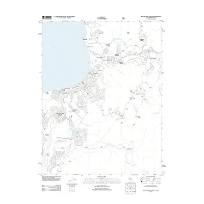
2012 Map of South Lake Tahoe
USGS Topo · Published 2012About this map
South Lake Tahoe sits at the nexus of California and Nevada, anchoring a landscape where alpine recreation and mid-century resort development meet. The map reveals the dense residential and commercial corridors of Al Tahoe and Bijou Park along the southern shore of Lake Tahoe, as well as the high-elevation settlements like Kingsbury Village and Summit Village situated near Daggett Pass. This era shows the established infrastructure of a world-class destination, including the Heavenly Valley Ski Area and Lake Tahoe Airport, alongside local anchors like Lake Tahoe Community College. Beyond the developed lakeshore, the geography rises steeply toward Monument Peak and East Peak, where numerous forest service routes and trails like 12n41 traverse the high meadows and ridges. This map captures the intricate balance between the built environment of Stateline and the protected natural spaces of the Nevada Beach Forest Camp.
Find a feature on this map
170 named features on this map. Tap any name to fly to it.
Don’t see what you’re looking for? This feature index may not catch every label — zoom into the map to look around manually.
Map Details
Editions of this 2012 South Lake Tahoe Map
This is the sole edition of this map. No revisions or reprints were ever made.
Other maps of this area

1889 · Pyramid Peak
USGS Topo · 1:125,000

1889 · Markleeville
USGS Topo · 1:125,000

1891 · Carson
USGS Topo · 1:125,000

1891 · Markleeville
USGS Topo · 1:125,000

1891 · Truckee
USGS Topo · 1:125,000

1891 · Pyramid Peak
USGS Topo · 1:125,000

1893 · Carson
USGS Topo · 1:125,000

1893 · Markleeville
USGS Topo · 1:125,000

1893 · Truckee
USGS Topo · 1:125,000

1895 · Pyramid Peak
USGS Topo · 1:125,000