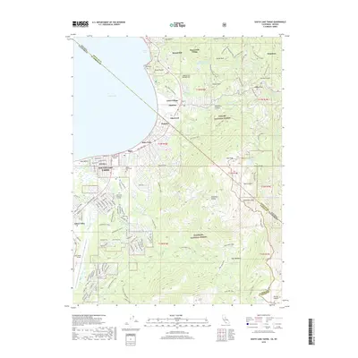
2018 Map of South Lake Tahoe
USGS Topo · Published 2018About this map
South Lake Tahoe and the California-Nevada state line serve as the focal point for this 2018 survey, documenting the dense development along the southern shore of Lake Tahoe. The map traces the transition from the lakeside urban corridor of Stateline, Bijou, and Al Tahoe into the protected wilderness of the Eldorado National Forest and Toiyabe National Forest. Infrastructure for the modern mountain economy is prominent, from the Lake Tahoe Airport to the Lake Tahoe Community College campus and the historic Happy Homestead Cemetery. High-elevation topography defines the eastern half of the sheet, where the Carson Range rises toward Monument Peak and East Peak. A complex network of trails, including the Tahoe Rim Trail and Van Sickle Trail, provides a detailed look at the recreational landscape of the modern era.
Find a feature on this map
62 named features on this map. Tap any name to fly to it.
Don’t see what you’re looking for? This feature index may not catch every label — zoom into the map to look around manually.
Map Details
Editions of this 2018 South Lake Tahoe Map
This is the sole edition of this map. No revisions or reprints were ever made.
Other maps of this area

1889 · Pyramid Peak
USGS Topo · 1:125,000

1889 · Markleeville
USGS Topo · 1:125,000

1891 · Carson
USGS Topo · 1:125,000

1891 · Markleeville
USGS Topo · 1:125,000

1891 · Truckee
USGS Topo · 1:125,000

1891 · Pyramid Peak
USGS Topo · 1:125,000

1893 · Carson
USGS Topo · 1:125,000

1893 · Markleeville
USGS Topo · 1:125,000

1893 · Truckee
USGS Topo · 1:125,000

1895 · Pyramid Peak
USGS Topo · 1:125,000