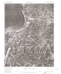
1974 Map of South Lake Tahoe
USGS Topo · Published 1977About this map
Lake Tahoe borders a rapidly developing landscape in this mid-1970s orthophotograph, where the transition from alpine waters to urban density is captured with striking clarity. The imagery highlights the concentrated development at the bi-state border, centered on Stateline and the growing municipality of South Lake Tahoe. Beyond the grid of streets and residential clusters, the terrain rises sharply into the Carson Range, showing the tight relationship between the shoreline community and the surrounding mountain slopes. This photographic survey provides an essential view of the area's infrastructure before late-century expansion, documenting the footprint of the resorts and neighborhoods that established this region as a premier mountain destination.
Find a feature on this map
4 named features on this map. Tap any name to fly to it.
Don’t see what you’re looking for? This feature index may not catch every label — zoom into the map to look around manually.
Map Details
Editions of this 1974 South Lake Tahoe Map
This is the sole edition of this map. No revisions or reprints were ever made.
Other maps of this area

1889 · Pyramid Peak
USGS Topo · 1:125,000

1889 · Markleeville
USGS Topo · 1:125,000

1891 · Carson
USGS Topo · 1:125,000

1891 · Markleeville
USGS Topo · 1:125,000

1891 · Truckee
USGS Topo · 1:125,000

1891 · Pyramid Peak
USGS Topo · 1:125,000

1893 · Carson
USGS Topo · 1:125,000

1893 · Markleeville
USGS Topo · 1:125,000

1893 · Truckee
USGS Topo · 1:125,000

1895 · Pyramid Peak
USGS Topo · 1:125,000