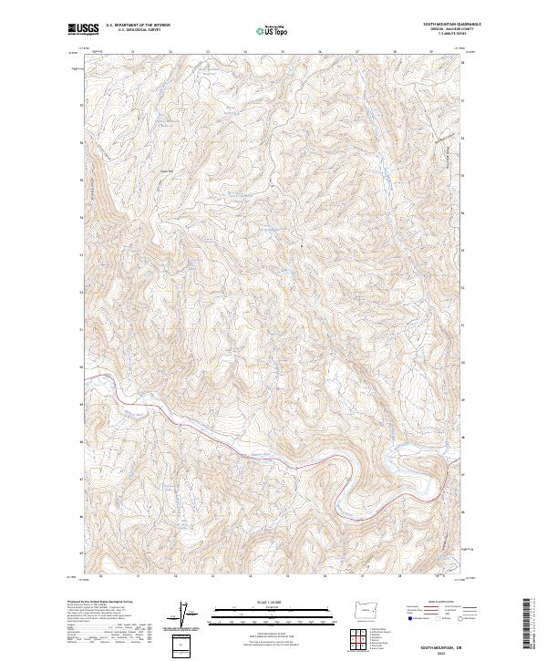
2023 Map of South Mountain
USGS Topo · Published 2023About this map
The Malheur River cuts across the southern portion of this high-desert landscape, serving as a primary hydrological artery for a network of seasonal streams and springs. High-elevation water management is evident throughout the terrain, with features such as South Mountain Reservoir, Alfred Reservoir, and Hog Cr Reservoir Number Two strategically placed to collect runoff from the slopes of South Mtn and Hog Creek Ridge. These catchments, alongside named watering points like Boney Spring Number 1 and Rimrock Spring, highlight the essential infrastructure required for ranching and land use in this arid region. The topography is defined by deep incisions like Black Canyon and Red Rock Canyon, which drain into the river valley. Sparse transport routes, including Shelley Rd and Antelope Spring Rd, provide the only modern access through the township and range sections that divide this remote corner of Malheur County.
Find a feature on this map
36 named features on this map. Tap any name to fly to it.
Don’t see what you’re looking for? This feature index may not catch every label — zoom into the map to look around manually.
Map Details
Editions of this 2023 South Mountain Map
This is the sole edition of this map. No revisions or reprints were ever made.
Other maps of this area

1955 · Boise
USGS Topo · 1:250,000

1958 · Boise
USGS Topo · 1:250,000

1962 · Boise
USGS Topo · 1:250,000

1966 · Harper
USGS Topo · 1:62,500

1966 · Westfall Butte
USGS Topo · 1:62,500

1972 · Tims Peak
USGS Topo · 1:24,000

1972 · Avery Creek
USGS Topo · 1:24,000
1972 · Monument Peak
USGS Topo · 1:24,000
1990 · South Mountain
USGS Topo · 1:24,000
1990 · Westfall
USGS Topo · 1:24,000