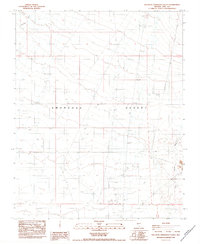
1984 Map of South of Amargosa Valley
USGS Topo · Published 1984About this map
The Amargosa Desert landscape in the mid-1980s reveals a region defined by arid-land resource extraction and infrastructure. While the terrain is largely dominated by extensive 4wd tracks and dry watercourses like Fortymile Wash, a distinct human presence is concentrated near a Trailer Park and an Athletic Field. This 1984 study captures a moment when geological exploration was active, evidenced by numerous Prospect sites and Gravel Pit operations scattered across the desert floor.
Find a feature on this map
36 named features on this map. Tap any name to fly to it.
Don’t see what you’re looking for? This feature index may not catch every label — zoom into the map to look around manually.
Map Details
Editions of this 1984 South of Amargosa Valley Map
This is the sole edition of this map. No revisions or reprints were ever made.
Other maps of this area

1908 · Furnace Creek
USGS Topo · 1:250,000

1910 · Furnace Creek
USGS Topo · 1:250,000

1942 · Skull Mountain
USGS Topo · 1:125,000

1942 · Bullfrog
USGS Topo · 1:125,000

1948 · Death Valley
USGS Topo · 1:250,000

1952 · Ash Meadows
USGS Topo · 1:62,500

1952 · Ryan
USGS Topo · 1:62,500

1952 · Big Dune
USGS Topo · 1:62,500

1954 · Death Valley
USGS Topo · 1:250,000

1956 · Death Valley
USGS Topo · 1:250,000