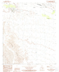
1988 Map of South of Lukeville
USGS Topo · Published 1988About this map
Sonoita serves as the primary cross-border anchor in this late 20th-century survey of the Sonoran frontier. The international boundary bisects the arid landscape, separating the southern edge of Organ Pipe Cactus National Monument in Arizona from the complex network of Mexican settlements and ranchos. To the north, the Sonoyta Valley and isolated landmarks like Gachado Well indicate the reliance on water sources in this desert environment. South of the border, the terrain shifts dramatically into the high peaks of the Sierra Cubabi. The map details a transition from American conservation land to a populated Mexican agricultural and residential landscape, including smaller communities such as Hombres Blancos, Adolfo Lopez Mateos, and Emancipación Obregonista, many of which are linked by unimproved roads and trails across the rugged desert floor.
Find a feature on this map
23 named features on this map. Tap any name to fly to it.
Don’t see what you’re looking for? This feature index may not catch every label — zoom into the map to look around manually.
Map Details
Editions of this 1988 South of Lukeville Map
This is the sole edition of this map. No revisions or reprints were ever made.
Other maps of this area

1954 · Sonoyta
USGS Topo · 1:250,000

1963 · Lukeville
USGS Topo · 1:62,500

1963 · Lukeville
USGS Topo · 1:250,000

1963 · Diaz Peak
USGS Topo · 1:62,500
1988 · Blankenship Well
USGS Topo · 1:24,000
1988 · Lukeville
USGS Topo · 1:24,000
1988 · Diaz Peak
USGS Topo · 1:24,000
1988 · West of Lukeville
USGS Topo · 1:24,000
1994 · Lukeville
USGS Topo · 1:100,000
1996 · South of Lukeville
USGS Topo · 1:24,000